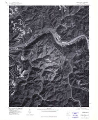
1977 Map of Cedar Grove
USGS Topo · Published 1980About this map
The Kanawha River carves a deep, winding path through the West Virginia landscape, anchoring the industrial and residential development of this river valley in the late 1970s. This orthophotoquad, produced from 1977 aerial imagery, reveals the dense vegetation and narrow hollows characteristic of the region, where settlements like Cedar Grove and Chelyan cling to the flat benches of land along the water. The intricate network of ridgelines and drainage basins is clearly visible, showing how the topography has dictated the placement of roads and towns. Smaller communities such as Dry Branch and Miami are tucked into the valleys of Cabin Creek and Paint Creek, demonstrating the traditional pattern of Appalachian settlement following the watercourses into the interior. At Hugheston, the proximity of industrial activity to the river highlights the importance of the Kanawha as a primary transportation artery for the state's natural resources.
Find a feature on this map
8 named features on this map. Tap any name to fly to it.
Don’t see what you’re looking for? This feature index may not catch every label — zoom into the map to look around manually.
Map Details
Editions of this 1977 Cedar Grove Map
This is the sole edition of this map. No revisions or reprints were ever made.
Other maps of this area

1897 · Kanawha Falls
USGS Topo · 1:125,000

1899 · Charleston
USGS Topo · 1:125,000

1900 · Kanawha Falls
USGS Topo · 1:125,000

1901 · Kanawha Falls
USGS Topo · 1:125,000

1907 · Clendenin
USGS Topo · 1:62,500

1908 · Montgomery
USGS Topo · 1:48,000

1909 · Charleston
USGS Topo · 1:62,500

1909 · Clendenin
USGS Topo · 1:62,500

1909 · Peytona
USGS Topo · 1:48,000

1910 · Montgomery
USGS Topo · 1:62,500