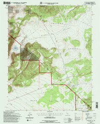
1994 Map of Cedar Hill
USGS Topo · Published 1997About this map
Toiyabe National Forest and Inyo National Forest dominate this high-altitude landscape along the border of Mineral and Mono counties. The dramatic terrain is centered on Cedar Hill, which rises above the expansive basins of Alkali Valley to the north and Mono Valley to the south. This 1994 revision by the U.S. Forest Service documents a landscape defined by natural features and resource extraction, marked by numerous Prospect sites, a Gravel Pit, and a Cinder Pit. A primary historical marker on this sheet is the Von Schmidt Nevada California Boundary, tracing the diagonal state line across the high desert. Smaller water features like Larkin Lake and Sulphur Pond provide rare reliable landmarks in this arid environment, while a network of unimproved roads and four-wheel-drive trails provides the only access through Trench Canyon and the surrounding peaks.
Find a feature on this map
22 named features on this map. Tap any name to fly to it.
Don’t see what you’re looking for? This feature index may not catch every label — zoom into the map to look around manually.
Map Details
Editions of this 1994 Cedar Hill Map
2 editions found
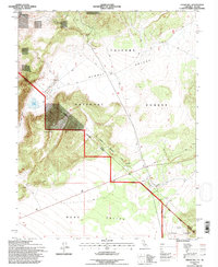
Other maps of this area

1909 · Hawthorne
USGS Topo · 1:250,000

1911 · Hawthorne
USGS Topo · 1:250,000

1915 · Hawthorne
USGS Topo · 1:250,000

1948 · Walker Lake
USGS Topo · 1:250,000

1955 · Powell Mtn
USGS Topo · 1:62,500

1956 · Aurora
USGS Topo · 1:62,500

1957 · Walker Lake
USGS Topo · 1:250,000

1958 · Trench Canyon
USGS Topo · 1:62,500

1958 · Huntoon Valley
USGS Topo · 1:62,500

1962 · Walker Lake
USGS Topo · 1:250,000