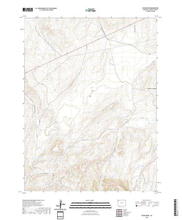
2022 Map of Cedar Knob
USGS Topo · Published 2022About this map
Cedar Knob stands as a prominent high point in this corner of Moffat County, overlooking a landscape defined by dramatic ridges and complex drainage systems. The terrain is divided by the massive Wild Horse Ridge and Elk Springs Ridge, which channel water through numerous draws and gulches. The road network, including Co RD 59 and Co RD 23, follows these natural corridors, connecting the high country to the lower basins. The mapping indicates a place of significant topographical relief, where seasonal water sources like Cedar Springs and namesake features like Lone Tree Gulch provided vital landmarks for ranchers and land managers. The surveyor's grid highlights the organized township and range divisions, showing how human boundaries were superimposed on the winding paths of Bob Hughes Cr and Deception Cr.
Find a feature on this map
22 named features on this map. Tap any name to fly to it.
Don’t see what you’re looking for? This feature index may not catch every label — zoom into the map to look around manually.
Map Details
Editions of this 2022 Cedar Knob Map
This is the sole edition of this map. No revisions or reprints were ever made.
Other maps of this area

1907 · White River
USGS Topo · 1:125,000

1910 · White River
USGS Topo · 1:125,000

1954 · Vernal
USGS Topo · 1:250,000

1958 · Vernal
USGS Topo · 1:250,000

1958 · Maybell
USGS Topo · 1:62,500

1958 · Citadel Plateau
USGS Topo · 1:62,500

1960 · Vernal
USGS Topo · 1:250,000

1960 · Elk Springs
USGS Topo · 1:62,500

1960 · Lone Mountain
USGS Topo · 1:62,500
1979 · Rangely
USGS Topo · 1:100,000