
1954 Map of Cedar Rapids
USGS Topo · Published 1956About this map
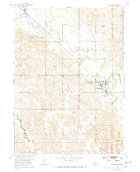
The Cedar River valley in Boone County serves as the central corridor for both rail and settlement in the mid-1950s. The Union Pacific railroad tracks parallel the winding river, connecting the primary town of Cedar Rapids with the smaller village of Primrose to the northwest. This agricultural landscape is meticulously divided by township lines, including Dublin, Roselma, and Cedar, which reveal a network of rural education sites such as School No 14, Standard Sch, and School No 48.
Find a feature on this map
18 named features on this map. Tap any name to fly to it.
Don’t see what you’re looking for? This feature index may not catch every label — zoom into the map to look around manually.
Map Details
Editions of this 1954 Cedar Rapids Map
Other maps of this area

1899 · St. Paul
USGS Topo · 1:125,000

1954 · Spalding
USGS Topo · 1:24,000

1954 · Akron
USGS Topo · 1:24,000

1954 · Wolbach NE
USGS Topo · 1:24,000

1954 · Albion West
USGS Topo · 1:24,000

1954 · Belgrade
USGS Topo · 1:24,000

1954 · Belgrade NW
USGS Topo · 1:24,000

1954 · Cedar Rapids SE
USGS Topo · 1:24,000

1954 · Spalding SE
USGS Topo · 1:24,000

1955 · Broken Bow
USGS Topo · 1:250,000