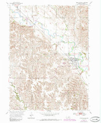
1954 Map of Cedar Rapids
USGS Topo · Published 1985About this map
Cedar River meanders through the heart of this mid-century Nebraska landscape, defining the agricultural and industrial development of Boone County. The town of Cedar Rapids serves as the primary hub, situated where the Union Pacific railroad tracks parallel the river's course. This transit corridor was essential for moving local harvests and connecting the village of Primrose to wider markets. The terrain is characterized by a mix of flat river bottomlands and the rising elevation of Pilot Knob to the west. Local genealogy and history are preserved at sites like St Anthony Cem and Sunset Cem, while the inclusion of the Cedar Rapids Municipal Airport reflects the modernization of rural transport. The map also captures smaller drainage patterns such as Silver Creek and various unnamed branches feeding into the main river valley.
Find a feature on this map
11 named features on this map. Tap any name to fly to it.
Don’t see what you’re looking for? This feature index may not catch every label — zoom into the map to look around manually.
Map Details
Editions of this 1954 Cedar Rapids Map
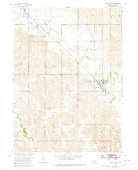
Other maps of this area

1899 · St. Paul
USGS Topo · 1:125,000

1954 · Cedar Rapids
USGS Topo · 1:24,000

1954 · Spalding
USGS Topo · 1:24,000

1954 · Akron
USGS Topo · 1:24,000

1954 · Wolbach NE
USGS Topo · 1:24,000

1954 · Albion West
USGS Topo · 1:24,000

1954 · Belgrade
USGS Topo · 1:24,000

1954 · Belgrade NW
USGS Topo · 1:24,000

1954 · Cedar Rapids SE
USGS Topo · 1:24,000

1954 · Spalding SE
USGS Topo · 1:24,000