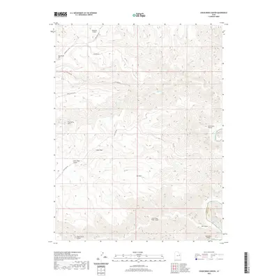
2020 Map of Cedar Ridge Canyon
USGS Topo · Published 2020About this map
Desolation Canyon and the winding course of the Green River define the southeastern corner of this landscape, where the Carbon Co - Uintah Co boundary meets the water at Flat Canyon Rapids. The map illustrates a high-desert plateau of deep erosion and livestock grazing history, centered on the prominent Cedar Ridge and Stephens Mesa. A network of unpaved access routes like Cedar Ridge Rd and Sagebrush Flat Rd navigate the complex topography of Big Swale and Pinnacle Canyon. The nomenclature, including Lunts Horse Pasture and Cedar Corral Canyon, reflects the region's enduring ties to ranching and open-range land use in the eastern Utah wilderness.
Find a feature on this map
20 named features on this map. Tap any name to fly to it.
Don’t see what you’re looking for? This feature index may not catch every label — zoom into the map to look around manually.
Map Details
Editions of this 2020 Cedar Ridge Canyon Map
This is the sole edition of this map. No revisions or reprints were ever made.
Other maps of this area

1885 · East Tavaputs
USGS Topo · 1:250,000

1886 · Price River
USGS Topo · 1:250,000

1896 · Price River
USGS Topo · 1:250,000

1953 · Nutters Hole
USGS Topo · 1:62,500

1953 · Firewater Canyon
USGS Topo · 1:62,500

1954 · Flat Canyon
USGS Topo · 1:62,500

1956 · Price
USGS Topo · 1:250,000

1956 · Grand Junction
USGS Topo · 1:250,000

1959 · Grand Junction
USGS Topo · 1:250,000

1960 · Price
USGS Topo · 1:250,000