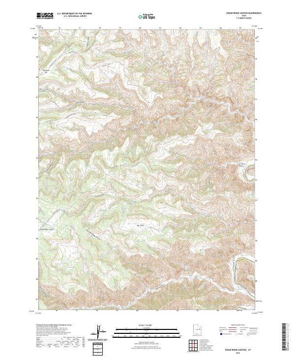
2023 Map of Cedar Ridge Canyon
USGS Topo · Published 2023About this map
The Green River carves a deep path through the eastern edge of this territory, defining the dramatic geology of Desolation Canyon as it flows past the Flat Canyon Rapids. This landscape is dominated by high plateaus and ancient drainage patterns, including Stephens Mesa and the expansive Indian Springs Mesa. Connectivity in this isolated region is maintained by a network of unpaved tracks such as Cedar Ridge Rd and Horse Bench RD, which navigate the high ground between Cedar Ridge Canyon and Little Cedar Ridge Canyon. The boundary between Carbon and Uintah counties follows the river's course, highlighting the historical use of water features as political demarcations in the high desert. Notable family-named or descriptive landmarks like Lunts Horse Pasture and Sage Brush Flat suggest a history of seasonal grazing and ranching utilization across the high benches.
Find a feature on this map
22 named features on this map. Tap any name to fly to it.
Don’t see what you’re looking for? This feature index may not catch every label — zoom into the map to look around manually.
Map Details
Editions of this 2023 Cedar Ridge Canyon Map
This is the sole edition of this map. No revisions or reprints were ever made.
Other maps of this area

1885 · East Tavaputs
USGS Topo · 1:250,000

1886 · Price River
USGS Topo · 1:250,000

1896 · Price River
USGS Topo · 1:250,000

1953 · Nutters Hole
USGS Topo · 1:62,500

1953 · Firewater Canyon
USGS Topo · 1:62,500

1954 · Flat Canyon
USGS Topo · 1:62,500

1956 · Price
USGS Topo · 1:250,000

1956 · Grand Junction
USGS Topo · 1:250,000

1959 · Grand Junction
USGS Topo · 1:250,000

1960 · Price
USGS Topo · 1:250,000