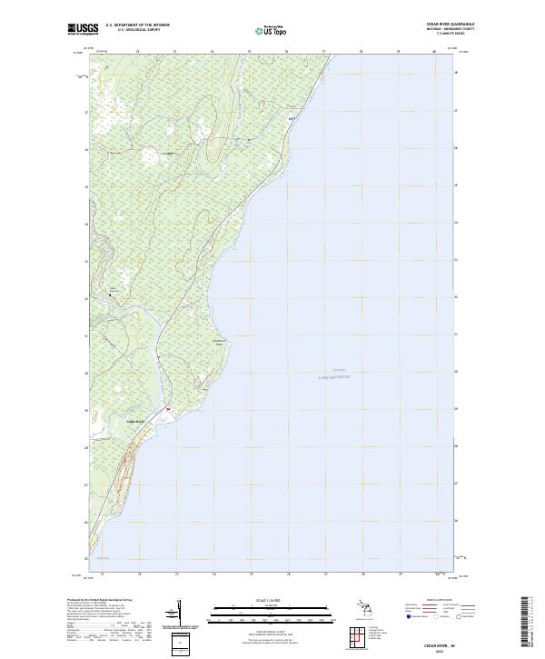
2023 Map of Cedar River
USGS Topo · Published 2023About this map
Cedar River sits at the confluence of several water systems along the shores of Green Bay in Menominee County. The landscape is characterized by the winding paths of the Walton River and Elwood Creek, which drain into the main channel near the lakefront. The settlement pattern follows the shoreline, with Deadmans Point serving as a distinct coastal landmark. Historical infrastructure is evident in the presence of Old Mill Lane No 20.75, suggesting a past tied to the region's timber or milling industry. Further north, the small settlement of Fox and the Cedar River Cem provide important reference points for genealogists tracking family roots in the Upper Peninsula. Modern roads like Cedar River Rd and Dunkas Rd now weave through these older land divisions, including those marked by the t35n r25w and t36n r24w township lines.
Find a feature on this map
20 named features on this map. Tap any name to fly to it.
Don’t see what you’re looking for? This feature index may not catch every label — zoom into the map to look around manually.
Map Details
Editions of this 2023 Cedar River Map
This is the sole edition of this map. No revisions or reprints were ever made.
Other maps of this area

1954 · Escanaba
USGS Topo · 1:250,000

1957 · Escanaba
USGS Topo · 1:250,000

1958 · Escanaba
USGS Topo · 1:250,000

1958 · Escanaba
USGS Topo · 1:62,500

1960 · Ellison Bay
USGS Topo · 1:62,500

1963 · Bark River
USGS Topo · 1:62,500

1963 · Cedar River
USGS Topo · 1:62,500

1981 · Marinette
USGS Topo · 1:100,000

1982 · Escanaba
USGS Topo · 1:100,000
1985 · Henderson Lakes
USGS Topo · 1:24,000