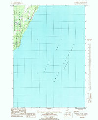
1985 Map of Henderson Lakes
USGS Topo · Published 1985About this map
Green Bay and Lake Michigan dominate the eastern expanse of this mid-1980s coastal survey, where the Upper Peninsula shoreline meets the water. Along the narrow terrestrial corridor, the Ford River and Bark River flow toward the bay, carving through the dense timberlands of the Escanaba River State Forest. The geography here is defined by small water bodies like Henderson Lakes and the public lands of O B Fuller County Park. Genealogists and local historians will find the South Ford River Cem situated near the northern boundary, providing a specific point of interest for family research in this sparsely settled region of Delta County. The map captures the quiet, natural character of the Michigan shoreline before modern development altered these traditional drainage patterns.
Find a feature on this map
13 named features on this map. Tap any name to fly to it.
Don’t see what you’re looking for? This feature index may not catch every label — zoom into the map to look around manually.
Map Details
Editions of this 1985 Henderson Lakes Map
This is the sole edition of this map. No revisions or reprints were ever made.
Other maps of this area

1932 · Bark River NE
USGS Topo · 1:31,680

1954 · Escanaba
USGS Topo · 1:250,000

1957 · Escanaba
USGS Topo · 1:250,000

1958 · Escanaba
USGS Topo · 1:250,000

1958 · Escanaba
USGS Topo · 1:62,500

1960 · Ellison Bay
USGS Topo · 1:62,500

1963 · Bark River
USGS Topo · 1:62,500

1963 · Cedar River
USGS Topo · 1:62,500

1981 · Marinette
USGS Topo · 1:100,000

1982 · Escanaba
USGS Topo · 1:100,000