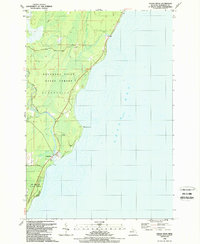
1989 Map of Cedar River
USGS Topo · Published 1989About this map
Green Bay defines the eastern edge of this Michigan shoreline, where the Cedar River meets the bay near the settlement of Cedar River. This 1980s revision reflects the coastal geography of Cedarville and the surrounding wilderness. Extensive public lands dominate the interior, including the Escanaba River State Forest and JW Wells State Park, protecting the natural drainage of the Walton River and Deer Creek. Local history is anchored by the Cedar River Cem and the small northern community of Fox. The map documents established infrastructure such as Cedar River Road and Camp Road, alongside maritime markers like the Light and Deadmans Point. This survey captures a balance between recreational development at the Boat Ramp and Fox County Park and the preserved timberlands that have long shaped the Menominee County coast.
Find a feature on this map
18 named features on this map. Tap any name to fly to it.
Don’t see what you’re looking for? This feature index may not catch every label — zoom into the map to look around manually.
Map Details
Editions of this 1989 Cedar River Map
This is the sole edition of this map. No revisions or reprints were ever made.
Other maps of this area

1954 · Escanaba
USGS Topo · 1:250,000

1957 · Escanaba
USGS Topo · 1:250,000

1958 · Escanaba
USGS Topo · 1:250,000

1958 · Escanaba
USGS Topo · 1:62,500

1960 · Ellison Bay
USGS Topo · 1:62,500

1963 · Bark River
USGS Topo · 1:62,500

1963 · Cedar River
USGS Topo · 1:62,500

1981 · Marinette
USGS Topo · 1:100,000

1982 · Escanaba
USGS Topo · 1:100,000
1985 · Henderson Lakes
USGS Topo · 1:24,000