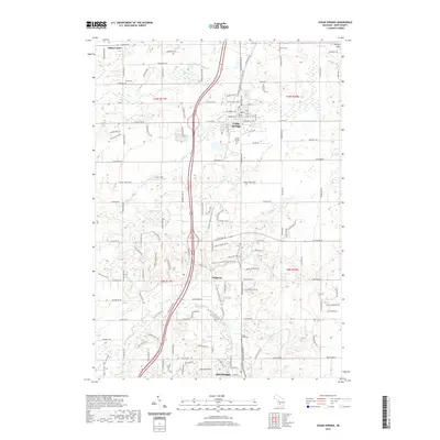
2019 Map of Cedar Springs
USGS Topo · Published 2019About this map
The Rogue River winds through the southern portion of this landscape, anchoring a region defined by established small settlements and recreational corridors. Central to the area is the community of Cedar Springs, where a grid of streets like E Muskegon St NE and W Pine St NE meet the Fred Meijer White Pine Trail State Park. This rail-to-trail conversion follows a historic transit corridor that once linked these timber and farming towns. To the south, the village of Edgerton and the settlement at Porter Hollow sit near the confluence of Stegman Cr and the river, while the N Country National Scenic Trail meanders through the central woodlands. Genealogists will find significant value in the distribution of local burial grounds, including the Briggs Family Cem near the river and Punches Cem in the northeast, which alongside Solon Center provide a clear map of 19th-century rural development.
Find a feature on this map
118 named features on this map. Tap any name to fly to it.
Don’t see what you’re looking for? This feature index may not catch every label — zoom into the map to look around manually.
Map Details
Editions of this 2019 Cedar Springs Map
This is the sole edition of this map. No revisions or reprints were ever made.
Other maps of this area

1918 · Cedar Springs
USGS Topo · 1:62,500

1943 · Cedar Springs
USGS Topo · 1:62,500

1954 · Midland
USGS Topo · 1:250,000

1958 · Midland
USGS Topo · 1:250,000

1958 · Sand Lake
USGS Topo · 1:62,500

1959 · Midland
USGS Topo · 1:250,000

1959 · Howard City
USGS Topo · 1:62,500

1966 · Midland
USGS Topo · 1:250,000

1967 · Sparta
USGS Topo · 1:24,000

1967 · Cedar Springs
USGS Topo · 1:24,000