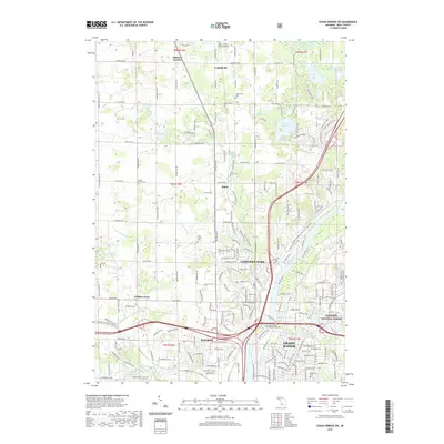
2019 Map of Cedar Springs SW
USGS Topo · Published 2019About this map
Grand Rapids and its northern suburbs are defined by the convergence of the Grand River and several tributary systems, including Indian Mill Creek and Mill Creek. This landscape shows the evolution of Kent County from a series of rural crossroads like Ballards Corners and Englishville into the modern municipalities of Walker and Comstock Park. The presence of the Grand Rapids Home For Veterans Cemetery and numerous family-named burial grounds like Pine Grove Cemetery and Brooklawn Cemetery provide specific points of interest for genealogists. Recreational and preserved spaces are prominent, including a section of the Manistee National Forest and the Fred Meijer White Pine Trail State Park, which follows a former rail corridor north from the city toward the Paul C Miller-Sparta Airport.
Find a feature on this map
48 named features on this map. Tap any name to fly to it.
Don’t see what you’re looking for? This feature index may not catch every label — zoom into the map to look around manually.
Map Details
Editions of this 2019 Cedar Springs SW Map
This is the sole edition of this map. No revisions or reprints were ever made.
Other maps of this area

1914 · Grand Rapids
USGS Topo · 1:62,500

1918 · Cedar Springs
USGS Topo · 1:62,500

1943 · Cedar Springs
USGS Topo · 1:62,500

1943 · Grand Rapids
USGS Topo · 1:62,500

1945 · Ravenna
USGS Topo · 1:62,500

1954 · Midland
USGS Topo · 1:250,000

1958 · Midland
USGS Topo · 1:250,000

1958 · Grandville
USGS Topo · 1:62,500

1958 · Grandville
USGS Topo · 1:24,000

1958 · Grand Rapids
USGS Topo · 1:250,000