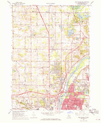
1967 Map of Cedar Springs SW
USGS Topo · Published 1969About this map
The Grand River and Rogue River converge in this mid-century survey of the northern reaches of Grand Rapids and the growing suburb of Walker. The landscape is a transition between the expanding urban footprint of neighborhoods like Northlawn and Ellsmere and the agricultural lands of Alpine and Sparta townships. A dense network of numbered roads, from 3 Mile Road up to 10 Mile Road, organizes the terrain, which is dotted with numerous small water bodies such as Baumhoff Lake and Little Pine Island Lake.
Find a feature on this map
93 named features on this map. Tap any name to fly to it.
Don’t see what you’re looking for? This feature index may not catch every label — zoom into the map to look around manually.
Map Details
Editions of this 1967 Cedar Springs SW Map
Other maps of this area

1914 · Grand Rapids
USGS Topo · 1:62,500

1918 · Cedar Springs
USGS Topo · 1:62,500

1943 · Cedar Springs
USGS Topo · 1:62,500

1943 · Grand Rapids
USGS Topo · 1:62,500

1945 · Ravenna
USGS Topo · 1:62,500

1954 · Midland
USGS Topo · 1:250,000

1958 · Midland
USGS Topo · 1:250,000

1958 · Grandville
USGS Topo · 1:62,500

1958 · Grandville
USGS Topo · 1:24,000

1958 · Grand Rapids
USGS Topo · 1:250,000
Featured Places
- Grand Rapids, MI
- Plainfield Charter Township, MI
- Walker, MI
- Alpine Township, MI
- Englishville, Alpine Township