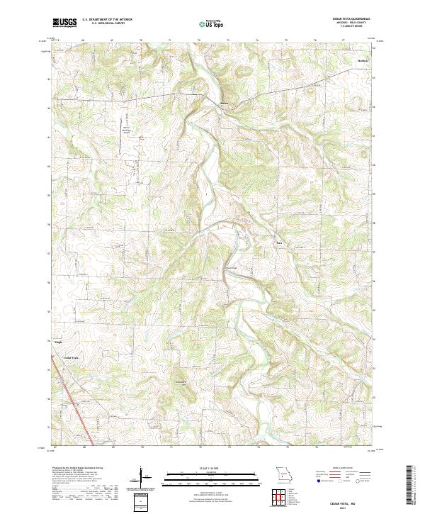
2021 Map of Cedar Vista
USGS Topo · Published 2021About this map
The Pomme de Terre River meanders through this Polk County landscape, defining the topography between the small settlements of Burns and Van. The area is characterized by a dense network of creek systems including Slagle Cr, Wolf Cr, and Sycamore Cr that feed into the river valley. In the southwest corner, Cedar Vista and Slagle sit near the transition to more open ground, while the Bolivar Municipal Airport provides a modern navigational landmark to the west. Local genealogy and land-use researchers will find value in the specific placement of family-named landmarks such as Graveyard Hill and crossing points like Sunset Bridge. The map captures a rural Missouri community where state highways such as State Hwy AA and State Hwy YY connect dispersed farmsteads and creek-side dwellings.
Find a feature on this map
75 named features on this map. Tap any name to fly to it.
Don’t see what you’re looking for? This feature index may not catch every label — zoom into the map to look around manually.
Map Details
Editions of this 2021 Cedar Vista Map
This is the sole edition of this map. No revisions or reprints were ever made.
Other maps of this area

1884 · Springfield
USGS Topo · 1:125,000

1884 · Bolivar
USGS Topo · 1:125,000

1886 · Springfield
USGS Topo · 1:125,000

1892 · Bolivar
USGS Topo · 1:125,000

1947 · Strafford
USGS Topo · 1:62,500

1948 · Strafford
USGS Topo · 1:62,500

1950 · Buffalo NW
USGS Topo · 1:24,000

1950 · Polk
USGS Topo · 1:24,000

1950 · Cliquot
USGS Topo · 1:24,000

1951 · Buffalo NW
USGS Topo · 1:24,000