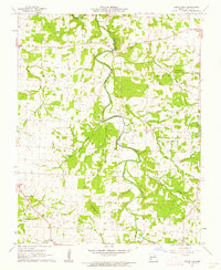
1961 Map of Cedar Vista
USGS Topo · Published 1962About this map
The Pomme De Terre River winds through this section of Polk County, Missouri, dictating the settlement patterns and roadway crossings of the early 1960s. Rural life is anchored by numerous community churches and cemeteries, such as Cem Mt Gilead Ch and New Bethel Ch, which served the surrounding townships of Marion, Benton, Looney, and Mooney. The map records a landscape of small hamlets like Slagle and Van, where local identity was often tied to the local congregation or school.
Find a feature on this map
33 named features on this map. Tap any name to fly to it.
Don’t see what you’re looking for? This feature index may not catch every label — zoom into the map to look around manually.
Map Details
Editions of this 1961 Cedar Vista Map
This is the sole edition of this map. No revisions or reprints were ever made.
Other maps of this area

1884 · Springfield
USGS Topo · 1:125,000

1884 · Bolivar
USGS Topo · 1:125,000

1886 · Springfield
USGS Topo · 1:125,000

1892 · Bolivar
USGS Topo · 1:125,000

1947 · Strafford
USGS Topo · 1:62,500

1948 · Strafford
USGS Topo · 1:62,500

1950 · Buffalo NW
USGS Topo · 1:24,000

1950 · Polk
USGS Topo · 1:24,000

1950 · Cliquot
USGS Topo · 1:24,000

1951 · Buffalo NW
USGS Topo · 1:24,000