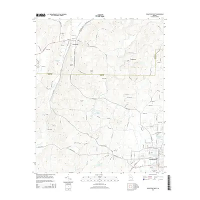
2014 Map of Cedartown West
USGS Topo · Published 2014About this map
Cedartown anchors the southeastern corner of this landscape, where the street grid gives way to the ridges and valleys of the Georgia-Alabama borderlands. This 2014 survey documents the enduring settlement patterns of Polk and Floyd Counties, from the cluster of Cave Spring near the namesake spring and Old Mill Spring to the historic rural community of Chubbtown. The map illustrates a region defined by its water sources and topography, with Little Cedar Cr and Dry Creek winding through the terrain between Padlock Mountain Rd SW and the drainage of Tan Yard Br. Genealogists will find significant value in the placement of several small burial grounds, including Hemphill Cem, Red Hill Cem, and the Chubb Road Cem, which mark the generational footprints of these upland communities. The western edge highlights the quiet reaches of Etna Valley, showing the intersection of local routes like Prior Station Rd and Blacksmith Rd.
Find a feature on this map
114 named features on this map. Tap any name to fly to it.
Don’t see what you’re looking for? This feature index may not catch every label — zoom into the map to look around manually.
Map Details
Editions of this 2014 Cedartown West Map
This is the sole edition of this map. No revisions or reprints were ever made.
Other maps of this area

1886 · Rome
USGS Topo · 1:125,000

1889 · Tallapoosa
USGS Topo · 1:125,000

1892 · Tallapoosa
USGS Topo · 1:125,000

1897 · Tallapoosa
USGS Topo · 1:125,000

1898 · Rome
USGS Topo · 1:125,000

1899 · Rome
USGS Topo · 1:125,000

1904 · Rome
USGS Topo · 1:125,000

1953 · Atlanta
USGS Topo · 1:250,000

1955 · Rome
USGS Topo · 1:250,000

1957 · Atlanta
USGS Topo · 1:250,000