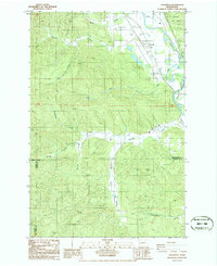
1986 Map of Cedarville
USGS Topo · Published 1986About this map
The Chehalis River defines the northeastern boundary of this landscape, where the settlement of Cedarville sits at the junction of several drainages including Rock Creek and Davis Creek. The map documents a working terrain where industry and infrastructure meet the edge of the Capitol State Forest. Evidence of local enterprise is visible through the numerous Borrow Pits and a designated Landing Strip situated along Garrard Creek. To the south, the community of Independence is tucked near the South Fork Garrard Creek. The presence of an Old Road Grade and several family-named water features like Kellogg Creek and Bloomquist Creek provides a clear view of the area's topographic development and land-use patterns in the mid-1980s.
Find a feature on this map
19 named features on this map. Tap any name to fly to it.
Don’t see what you’re looking for? This feature index may not catch every label — zoom into the map to look around manually.
Map Details
Editions of this 1986 Cedarville Map
2 editions found
Other maps of this area

1941 · Walville
USGS Topo · 1:62,500

1941 · Meskill
USGS Topo · 1:62,500

1941 · Gate
USGS Topo · 1:62,500

1941 · Ford
USGS Topo · 1:62,500

1953 · Hoquiam
USGS Topo · 1:250,000

1953 · Rochester
USGS Topo · 1:62,500

1953 · Pe Ell
USGS Topo · 1:62,500

1953 · Malone
USGS Topo · 1:62,500

1953 · Adna
USGS Topo · 1:62,500

1957 · Hoquiam
USGS Topo · 1:250,000