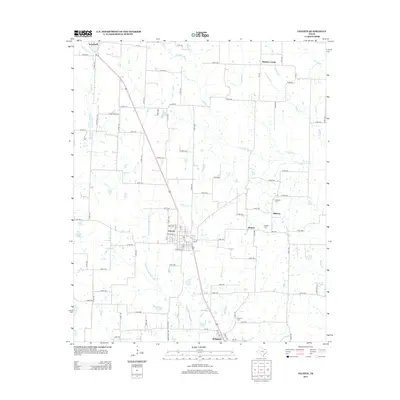
2013 Map of Celeste
USGS Topo · Published 2013About this map
Celeste serves as the central hub for this portion of North Texas, situated at the confluence of several regional routes and historical drainage systems. The landscape is defined by the headwaters of major river systems, including the S Sulphur River to the north and the meandering Cowleech Fork Sabine River to the south. Small rural communities like Hogeye, Midway, and Kingston anchor the surrounding agricultural lands, each connected by an extensive network of county roads. For those researching family history, the map identifies several local burial sites such as the Nicholson Cem, Celeste Cem, and Kingston Cem. The presence of numerous creeks, including Arnold Cr and Hickory Creek, illustrates the hydrological patterns that have dictated settlement and land use since the area was first developed.
Find a feature on this map
89 named features on this map. Tap any name to fly to it.
Don’t see what you’re looking for? This feature index may not catch every label — zoom into the map to look around manually.
Map Details
Editions of this 2013 Celeste Map
This is the sole edition of this map. No revisions or reprints were ever made.
Other maps of this area

1930 · Farmersville
USGS Topo · 1:62,500

1954 · Sherman
USGS Topo · 1:250,000

1958 · Sherman
USGS Topo · 1:250,000

1960 · Pike
USGS Topo · 1:24,000

1962 · Greenville NW
USGS Topo · 1:24,000

1962 · Farmersville
USGS Topo · 1:24,000

1963 · Greenville NE
USGS Topo · 1:24,000

1964 · Trenton
USGS Topo · 1:24,000

1964 · Celeste
USGS Topo · 1:24,000
1964 · Gober
USGS Topo · 1:24,000