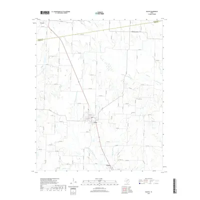
2019 Map of Celeste
USGS Topo · Published 2019About this map
Celeste and Kingston serve as the primary hubs of this North Texas landscape, where the agricultural plains meet the upper reaches of several vital waterways. The terrain is defined by the headwaters of the S Sulphur River and the Cowleech Fork Sabine River, which carve distinct paths through the rolling acreage along the border of Fannin and Hunt counties. The drainage network is particularly dense here, including Mustang Cr, Hickory Cr, and Tidwell Cr, illustrating the hydrology that has supported ranching and farming in this region for generations.
Find a feature on this map
82 named features on this map. Tap any name to fly to it.
Don’t see what you’re looking for? This feature index may not catch every label — zoom into the map to look around manually.
Map Details
Editions of this 2019 Celeste Map
This is the sole edition of this map. No revisions or reprints were ever made.
Other maps of this area

1930 · Farmersville
USGS Topo · 1:62,500

1954 · Sherman
USGS Topo · 1:250,000

1958 · Sherman
USGS Topo · 1:250,000

1960 · Pike
USGS Topo · 1:24,000

1962 · Greenville NW
USGS Topo · 1:24,000

1962 · Farmersville
USGS Topo · 1:24,000

1963 · Greenville NE
USGS Topo · 1:24,000

1964 · Trenton
USGS Topo · 1:24,000

1964 · Celeste
USGS Topo · 1:24,000
1964 · Gober
USGS Topo · 1:24,000