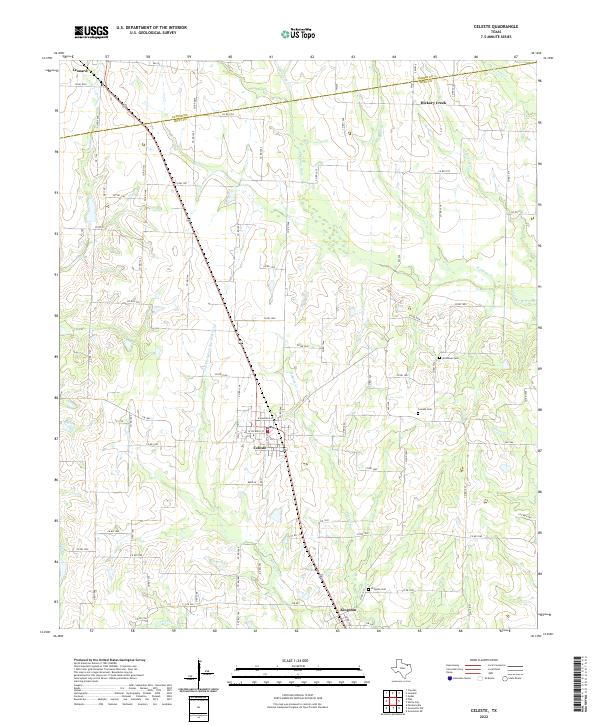
2022 Map of Celeste
USGS Topo · Published 2022About this map
Celeste and Kingston serve as the primary hubs in this north Texas landscape, situated along a primary transportation corridor that divides the drainage systems of the region. The map captures a detailed network of county roads and farm-to-market routes, such as FM 272 and FM 1562, which connect dispersed rural homesteads to these central settlements. For those researching family history in the area, the map highlights significant local landmarks including Nicholson Cem, Celeste Cem, and Kingston Cem.
Find a feature on this map
88 named features on this map. Tap any name to fly to it.
Don’t see what you’re looking for? This feature index may not catch every label — zoom into the map to look around manually.
Map Details
Editions of this 2022 Celeste Map
This is the sole edition of this map. No revisions or reprints were ever made.
Other maps of this area

1930 · Farmersville
USGS Topo · 1:62,500

1954 · Sherman
USGS Topo · 1:250,000

1958 · Sherman
USGS Topo · 1:250,000

1960 · Pike
USGS Topo · 1:24,000

1962 · Greenville NW
USGS Topo · 1:24,000

1962 · Farmersville
USGS Topo · 1:24,000

1963 · Greenville NE
USGS Topo · 1:24,000

1964 · Trenton
USGS Topo · 1:24,000

1964 · Celeste
USGS Topo · 1:24,000
1964 · Gober
USGS Topo · 1:24,000