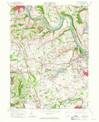
1964 Map of Cementon
USGS Topo · Published 1966About this map
The Lehigh River snakes through the center of this Lehigh Valley survey, serving as a primary corridor for both the Central Railroad of New Jersey and the Lehigh Valley Railroad. This era is defined by the heavy industrial extraction of the region, evidenced by the numerous Quarries and the Dewey Heights Quarry near Cementon. The landscape transitions from the river's industrial banks to the educational grounds of the Mary Immaculate Missionary College and onto the suburbanizing townships of North Whitehall and South Whitehall.
Find a feature on this map
102 named features on this map. Tap any name to fly to it.
Don’t see what you’re looking for? This feature index may not catch every label — zoom into the map to look around manually.
Map Details
Editions of this 1964 Cementon Map
Other maps of this area

1894 · Allentown
USGS Topo · 1:62,500

1902 · Slatington
USGS Topo · 1:62,500

1914 · Wind Gap
USGS Topo · 1:62,500

1916 · Wind Gap
USGS Topo · 1:62,500

1922 · Mauch Chunk
USGS Topo · 1:62,500

1924 · Mauch Chunk
USGS Topo · 1:62,500

1937 · Allentown West
USGS Topo · 1:48,000

1939 · Allentown
USGS Topo · 1:62,500

1942 · Allentown West
USGS Topo · 1:62,500

1943 · Mauch Chunk
USGS Topo · 1:62,500