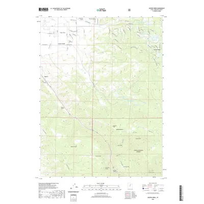
2020 Map of Center Creek
USGS Topo · Published 2020About this map
Heber Valley serves as the backdrop for this detailed topographical record of Wasatch County, where the transition from residential settlements to high-elevation canyonlands is clearly defined. The small community of Center Creek is anchored by the Center Creek Cem, while to the east, the development of Timber Lakes occupies the slopes beneath the Uinta National Forest. The map documents a sophisticated water management system through a network of reservoirs, including the Lower Bennett Lindsay Reservoir and several numbered basins such as Center Cr Number One Reservoir.
Find a feature on this map
58 named features on this map. Tap any name to fly to it.
Don’t see what you’re looking for? This feature index may not catch every label — zoom into the map to look around manually.
Map Details
Editions of this 2020 Center Creek Map
This is the sole edition of this map. No revisions or reprints were ever made.
Other maps of this area

1885 · Salt Lake
USGS Topo · 1:250,000

1900 · Coalville
USGS Topo · 1:125,000

1903 · Coalville
USGS Topo · 1:125,000

1907 · Strawberry Valley
USGS Topo · 1:125,000

1909 · Strawberry Valley
USGS Topo · 1:125,000

1954 · Salt Lake City
USGS Topo · 1:250,000

1955 · Heber
USGS Topo · 1:24,000

1958 · Salt Lake City
USGS Topo · 1:250,000

1960 · Salt Lake City
USGS Topo · 1:250,000
1966 · Charleston
USGS Topo · 1:24,000