
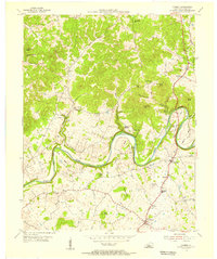
1953 Map of Center
USGS Topo · Published 1955About this map
Little Barren River carves a deep, winding path through the heart of this rural Kentucky landscape, defining the jagged boundaries where Hart, Metcalfe, and Green counties meet. The 1950s settlement pattern is anchored by small community centers like Center and Monroe, where life revolved around local congregations such as Allens Grove Ch and Bethel Ch. The terrain is marked by numerous family-named burial grounds including Bastin Cem and Hedgespeth Cem, providing a detailed record for genealogical research in these uplands.
Find a feature on this map
50 named features on this map. Tap any name to fly to it.
Don’t see what you’re looking for? This feature index may not catch every label — zoom into the map to look around manually.
Map Details
Editions of this 1953 Center Map
This is the sole edition of this map. No revisions or reprints were ever made.
Other maps of this area

1934 · Munfordville
USGS Topo · 1:48,000

1935 · Horse Cave
USGS Topo · 1:48,000

1937 · Munfordville
USGS Topo · 1:62,500

1938 · Horse Cave
USGS Topo · 1:62,500

1953 · Sulphur Well
USGS Topo · 1:24,000

1953 · Hudgins
USGS Topo · 1:24,000

1953 · Summersville
USGS Topo · 1:24,000

1953 · Exie
USGS Topo · 1:24,000

1953 · East Fork
USGS Topo · 1:24,000
1953 · Canmer
USGS Topo · 1:24,000