
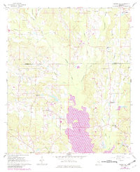
1962 Map of Center Hill
USGS Topo · Published 1963About this map
Okatibbee Creek and its many tributaries, including Chickasawhay Creek, Tompeat Creek, and Gin Creek, carve through this rural landscape along the Kemper and Lauderdale County line. In the early 1960s, this area remained largely defined by small agricultural settlements and a dense network of country churches that served as community anchors. Settlements such as Klondike, Martin, and Center Hill are joined by numerous smaller locales like Shuektown and Hodge. A significant number of religious and memorial sites are documented here, from Frazier Grove Ch and Union Ch to the Chisholm Cem and Hamrick Cem. The presence of a Fish Hatchery and a Lookout Tower near Collinsville suggests a landscape managed for both natural resources and conservation during this period.
Find a feature on this map
39 named features on this map. Tap any name to fly to it.
Don’t see what you’re looking for? This feature index may not catch every label — zoom into the map to look around manually.
Map Details
Editions of this 1962 Center Hill Map
Other maps of this area

1921 · Meridian
USGS Topo · 1:48,000

1923 · Meridian
USGS Topo · 1:62,500

1953 · Meridian
USGS Topo · 1:250,000

1957 · Meridian
USGS Topo · 1:250,000

1957 · Chunky
USGS Topo · 1:62,500

1962 · House
USGS Topo · 1:24,000

1962 · Daleville
USGS Topo · 1:24,000

1962 · Lauderdale NW
USGS Topo · 1:24,000

1962 · Post
USGS Topo · 1:24,000

1962 · Moscow
USGS Topo · 1:24,000