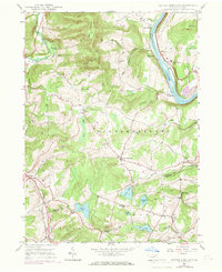
1946 Map of Center Moreland
USGS Topo · Published 1969About this map
Center Moreland serves as the central hub of this mid-century Pennsylvania landscape, where the Wyoming Co Luzerne Co border meets a network of upland farms and valley settlements. The eastern edge is defined by the sweeping bend of the Susquehanna River, followed closely by the tracks of the Lehigh Valley railroad and small riverside communities like Whites Ferry and Keelersburg.
Find a feature on this map
47 named features on this map. Tap any name to fly to it.
Don’t see what you’re looking for? This feature index may not catch every label — zoom into the map to look around manually.
Map Details
Editions of this 1946 Center Moreland Map
Other maps of this area

1891 · Harveys Lake
USGS Topo · 1:62,500

1893 · Harvey Lake
USGS Topo · 1:62,500

1893 · Pittston
USGS Topo · 1:62,500

1943 · Scranton
USGS Topo · 1:125,000

1945 · Meshoppen
USGS Topo · 1:62,500

1945 · Meshoppen
USGS Topo · 1:24,000

1946 · Tunkhannock
USGS Topo · 1:62,500

1946 · Kingston
USGS Topo · 1:24,000

1946 · Harveys Lake
USGS Topo · 1:24,000

1946 · Noxen
USGS Topo · 1:24,000
Featured Places
- Dallas Township, PA
- Falls Township, PA
- Center Moreland, Northmoreland Township
- Keelersburg, Northmoreland Township
- Beaumont, Monroe Township