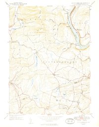
1949 Map of Center Moreland
USGS Topo · Published 1949About this map
The Susquehanna River carves a dominant path through this landscape, flanked by the Lehigh Valley railroad line. Near the riverbanks, small settlements such as Whites Ferry, Keelersburg, and Hoban Heights reflect the area's historical reliance on river and rail transport. To the west, the terrain rises toward Miller Mountain and Shaver Mountain, where the land is punctuated by rural community centers and family-named landmarks like Thurston Ch and the Hunter Sch.
Find a feature on this map
48 named features on this map. Tap any name to fly to it.
Don’t see what you’re looking for? This feature index may not catch every label — zoom into the map to look around manually.
Map Details
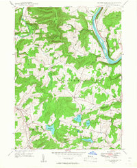
Editions of this 1949 Center Moreland Map
2 editions found
Other maps of this area

1891 · Harveys Lake
USGS Topo · 1:62,500

1893 · Harvey Lake
USGS Topo · 1:62,500

1893 · Pittston
USGS Topo · 1:62,500

1943 · Scranton
USGS Topo · 1:125,000

1945 · Meshoppen
USGS Topo · 1:62,500

1945 · Meshoppen
USGS Topo · 1:24,000

1946 · Tunkhannock
USGS Topo · 1:62,500

1946 · Kingston
USGS Topo · 1:24,000

1946 · Harveys Lake
USGS Topo · 1:24,000

1946 · Noxen
USGS Topo · 1:24,000
Featured Places
- Dallas Township, PA
- Falls Township, PA
- Center Moreland, Northmoreland Township
- Keelersburg, Northmoreland Township
- Beaumont, Monroe Township