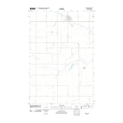
2011 Map of Center
USGS Topo · Published 2011About this map
Center stands as the primary hub of this landscape, situated in the upper northern portion of the quadrangle. The town's grid is clearly defined by several named thoroughfares, including Main St, Market St, and Oliver Ave, reflecting the organized layout of the Oliver County seat. Water management is a central theme of the surrounding terrain, most notably marked by the Square Butte Number 4 Dam to the southeast of the settlement. The hydrology is dominated by the winding paths of Square Butte Creek, which flows through the townsite, and Hagel Creek further south. The map illustrates a vast network of section-line roads, such as 40th Ave SW and 27th St SW, which partition the prairie into the characteristic square-mile blocks of the Great Plains, indicating a land primarily dedicated to rural agriculture and ranching.
Find a feature on this map
23 named features on this map. Tap any name to fly to it.
Don’t see what you’re looking for? This feature index may not catch every label — zoom into the map to look around manually.
Map Details
Editions of this 2011 Center Map
This is the sole edition of this map. No revisions or reprints were ever made.
Other maps of this area

1954 · Bismarck
USGS Topo · 1:250,000

1954 · McClusky
USGS Topo · 1:250,000

1958 · Bismarck
USGS Topo · 1:250,000

1958 · McClusky
USGS Topo · 1:250,000

1968 · Hannover NE
USGS Topo · 1:24,000

1968 · Fort Clark
USGS Topo · 1:24,000

1968 · Hannover NW
USGS Topo · 1:24,000

1970 · New Salem NW
USGS Topo · 1:24,000

1970 · New Salem NE
USGS Topo · 1:24,000

1972 · Center
USGS Topo · 1:24,000