
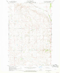
1968 Map of Fort Clark
USGS Topo · Published 1969About this map
Fort Clark sits at the northern edge of this high-plains landscape, situated just south of the winding Missouri River. The terrain is defined by the sharp transition from the river bottomlands to the elevated plateaus, where the Northern Pacific railroad tracks parallel the river valley. In the late 1960s, this area served as a critical boundary point between McLean County and Oliver County. To the east, Mandan Lake occupies a low-lying basin near the river's edge, contrasting with the dry, dissected uplands that dominate the southern half of the sheet. Evidence of local industry is sparse but present, notably at a Gravel Pit located among the undulating hills, indicating the extraction of glacial deposits for road and rail ballast during this era of regional development.
Find a feature on this map
6 named features on this map. Tap any name to fly to it.
Don’t see what you’re looking for? This feature index may not catch every label — zoom into the map to look around manually.
Map Details
Editions of this 1968 Fort Clark Map
This is the sole edition of this map. No revisions or reprints were ever made.
Other maps of this area

1948 · Stanton
USGS Topo · 1:62,500

1949 · Stanton
USGS Topo · 1:62,500

1949 · Washburn
USGS Topo · 1:62,500

1954 · McClusky
USGS Topo · 1:250,000

1958 · McClusky
USGS Topo · 1:250,000

1961 · Washburn
USGS Topo · 1:24,000

1967 · Washburn SW
USGS Topo · 1:24,000

1967 · Stanton SE
USGS Topo · 1:24,000

1968 · Hannover NE
USGS Topo · 1:24,000
1968 · Fort Clark NE
USGS Topo · 1:24,000