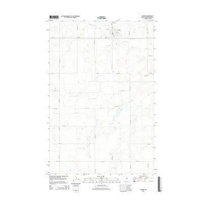
2014 Map of Center
USGS Topo · Published 2014About this map
Center stands as the primary hub of this North Dakota landscape, situated at the intersection of ND-48 and ND-25. This 2014 survey captures the township's organized grid, including Main St E and 3rd St W, which anchor the small community. Just north of the town center lies Saint Pauls Cem, a key landmark for genealogical research and local history. The surrounding terrain is defined by the drainage of Square Butte Cr to the north and the meandering path of Hagel Cr through the southern half of the quadrangle. A network of numbered roads, such as 25th St SW and 41st Ave SW, illustrates the precision of the rural road system, which facilitates agricultural access across the undulating plains. The map provides a clear view of the area's hydrology and transportation corridors as they existed in the early 21st century.
Find a feature on this map
23 named features on this map. Tap any name to fly to it.
Don’t see what you’re looking for? This feature index may not catch every label — zoom into the map to look around manually.
Map Details
Editions of this 2014 Center Map
This is the sole edition of this map. No revisions or reprints were ever made.
Other maps of this area

1954 · Bismarck
USGS Topo · 1:250,000

1954 · McClusky
USGS Topo · 1:250,000

1958 · Bismarck
USGS Topo · 1:250,000

1958 · McClusky
USGS Topo · 1:250,000

1968 · Hannover NE
USGS Topo · 1:24,000

1968 · Fort Clark
USGS Topo · 1:24,000

1968 · Hannover NW
USGS Topo · 1:24,000

1970 · New Salem NW
USGS Topo · 1:24,000

1970 · New Salem NE
USGS Topo · 1:24,000

1972 · Center
USGS Topo · 1:24,000