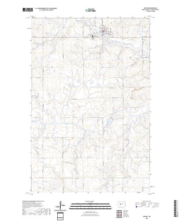
2024 Map of Center
USGS Topo · Published 2024About this map
Center stands as the primary hub of this North Dakota landscape, serving as the seat of local government at the Oliver County Courthouse. This 2024 survey documents the community's layout, where residential streets like Lincoln Ave and Butte Ave intersect with a grid of rural roads that stretch into the surrounding agricultural terrain. The town's historical and genealogical record is preserved in several burial sites, including the Hagerott Cem, Saint Martins Cem, and the Center Community Cem.
Find a feature on this map
32 named features on this map. Tap any name to fly to it.
Don’t see what you’re looking for? This feature index may not catch every label — zoom into the map to look around manually.
Map Details
Editions of this 2024 Center Map
This is the sole edition of this map. No revisions or reprints were ever made.
Other maps of this area
1954 · Bismarck
USGS Topo · 1:250,000
1954 · McClusky
USGS Topo · 1:250,000
1958 · Bismarck
USGS Topo · 1:250,000
1958 · McClusky
USGS Topo · 1:250,000
1968 · Hannover NE
USGS Topo · 1:24,000
1968 · Fort Clark
USGS Topo · 1:24,000
1968 · Hannover NW
USGS Topo · 1:24,000
1970 · New Salem NW
USGS Topo · 1:24,000
1970 · New Salem NE
USGS Topo · 1:24,000
1972 · Center
USGS Topo · 1:24,000