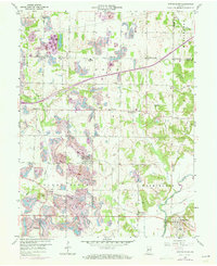
1957 Map of Center Point
USGS Topo · Published 1973About this map
Center Point serves as the central hub of this mid-century survey of Clay County, where the transition from agricultural land to industrial landscape is clearly visible. The terrain is marked by significant mining activity and drainage networks, particularly around Sugar Ridge and the Birch Creek valley. Water bodies like Lake of the Woods and the Dietz Lake recreation area contrast with the rural grid of farm-to-market roads. Local history is deeply etched into the landscape through family and community landmarks, including Roadman Corner, Hirt Corner, and numerous small cemeteries like Neidlinger Cem and Gremes Cem. Along the southeastern edge, the Eel River and its tributary Jordan Creek wind past the settlement of Bowling Green, while churches such as St Johns Ch and Mt Carmel Ch anchor the dispersed rural population of Jackson and Washington townships.
Find a feature on this map
40 named features on this map. Tap any name to fly to it.
Don’t see what you’re looking for? This feature index may not catch every label — zoom into the map to look around manually.
Map Details
Editions of this 1957 Center Point Map
3 editions found
Other maps of this area

1908 · Clay City
USGS Topo · 1:48,000

1910 · Clay City
USGS Topo · 1:62,500

1950 · Brazil East
USGS Topo · 1:24,000

1950 · Brazil West
USGS Topo · 1:24,000

1952 · Reelsville
USGS Topo · 1:24,000

1953 · Indianapolis
USGS Topo · 1:250,000

1956 · Indianapolis
USGS Topo · 1:250,000

1956 · Patricksburg
USGS Topo · 1:24,000

1957 · Indianapolis
USGS Topo · 1:250,000
1957 · Center Point
USGS Topo · 1:24,000