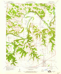
1959 Map of Center
USGS Topo · Published 1960About this map
The Salt River carves a deep, winding path through this portion of Ralls County, creating a sharp contrast between the flat upland agricultural plains and the densely wooded, dissected drainages like Johnson Hollow and Griffin Hollow. The town of Center serves as the primary hub in the south, while smaller rural nodes such as Cincinnati and Spalding reflect the distributed settlement pattern of the mid-20th century.
Find a feature on this map
32 named features on this map. Tap any name to fly to it.
Don’t see what you’re looking for? This feature index may not catch every label — zoom into the map to look around manually.
Map Details
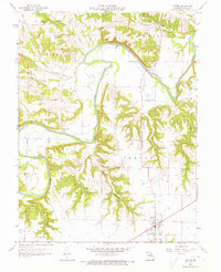
Editions of this 1959 Center Map
2 editions found
Other maps of this area

1890 · Louisiana
USGS Topo · 1:125,000

1890 · Mexico
USGS Topo · 1:125,000

1903 · Palmyra
USGS Topo · 1:125,000

1932 · Hannibal
USGS Topo · 1:62,500

1936 · Hannibal
USGS Topo · 1:48,000

1943 · Vandalia
USGS Topo · 1:62,500

1945 · Hannibal
USGS Topo · 1:62,500

1945 · Perry
USGS Topo · 1:62,500

1945 · Vandalia
USGS Topo · 1:62,500

1948 · Quincy
USGS Topo · 1:250,000