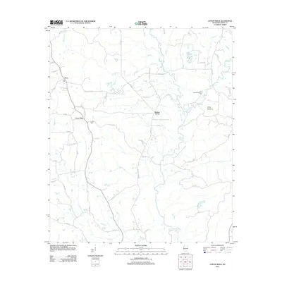
2012 Map of Center Ridge
USGS Topo · Published 2012About this map
Bezer and the rural crossroads of Center Ridge define the interior uplands of Smith County in this early 21st-century landscape. The area is heavily defined by its drainage systems, with the Leaf River carving through the southeast and several significant creeks, including Beaverdam Cr and Keys Mill Cr, branching across the territory. Local history is anchored by sites like Ditch Cem near Bezer and Burnett Cem, providing specific points of interest for genealogical research.
Find a feature on this map
53 named features on this map. Tap any name to fly to it.
Don’t see what you’re looking for? This feature index may not catch every label — zoom into the map to look around manually.
Map Details
Editions of this 2012 Center Ridge Map
This is the sole edition of this map. No revisions or reprints were ever made.
Other maps of this area

1953 · Hattiesburg
USGS Topo · 1:250,000

1953 · Meridian
USGS Topo · 1:250,000

1957 · Meridian
USGS Topo · 1:250,000

1958 · Hattiesburg
USGS Topo · 1:250,000

1965 · Meridian
USGS Topo · 1:250,000

1968 · Raleigh
USGS Topo · 1:24,000

1968 · Louin
USGS Topo · 1:24,000

1968 · Louin SW
USGS Topo · 1:24,000

1974 · Soso
USGS Topo · 1:24,000
1974 · Bay Springs
USGS Topo · 1:24,000