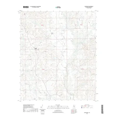
2018 Map of Center Ridge
USGS Topo · Published 2018About this map
Center Ridge serves as the focal point for this rural pocket of Smith County, where a network of county roads like Co RD 82 and Co RD 87 connects small communities and agricultural lands. The landscape is defined by the swampy bottomlands of the Leaf River and its numerous tributaries, including West Tallahala Creek and Keys Mill Cr. For those researching local history, the presence of family and community burial sites like Burnett Cem and Ditch Cem provides valuable genealogical anchors. The terrain transitions from the low wetlands of Beaverdam Cr to the prominent height of Flat Rock Hill in the northwest corner. This map documents a quiet, river-dependent region where the Beaverdam Baptist Church Cem remains a central landmark for the surrounding countryside.
Find a feature on this map
55 named features on this map. Tap any name to fly to it.
Don’t see what you’re looking for? This feature index may not catch every label — zoom into the map to look around manually.
Map Details
Editions of this 2018 Center Ridge Map
This is the sole edition of this map. No revisions or reprints were ever made.
Other maps of this area

1953 · Hattiesburg
USGS Topo · 1:250,000

1953 · Meridian
USGS Topo · 1:250,000

1957 · Meridian
USGS Topo · 1:250,000

1958 · Hattiesburg
USGS Topo · 1:250,000

1965 · Meridian
USGS Topo · 1:250,000

1968 · Raleigh
USGS Topo · 1:24,000

1968 · Louin
USGS Topo · 1:24,000

1968 · Louin SW
USGS Topo · 1:24,000

1974 · Soso
USGS Topo · 1:24,000
1974 · Bay Springs
USGS Topo · 1:24,000