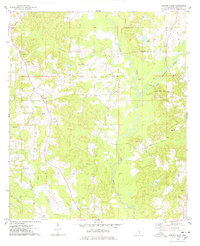
1975 Map of Center Ridge
USGS Topo · Published 1978About this map
Leaf River and its meandering tributaries dominate this mid-1970s landscape in Smith County, where the transition between agricultural land and industrial extraction is evident. The rural community of Center Ridge serves as a central point, surrounded by a network of country churches including Liberty Ch, Beaverdam Ch, and New Bethel Ch. These landmarks, along with Ditch Cem, provide significant touchpoints for genealogists tracing family roots in the Piney Woods region.
Find a feature on this map
24 named features on this map. Tap any name to fly to it.
Don’t see what you’re looking for? This feature index may not catch every label — zoom into the map to look around manually.
Map Details
Editions of this 1975 Center Ridge Map
This is the sole edition of this map. No revisions or reprints were ever made.
Other maps of this area

1953 · Hattiesburg
USGS Topo · 1:250,000

1953 · Meridian
USGS Topo · 1:250,000

1957 · Meridian
USGS Topo · 1:250,000

1958 · Hattiesburg
USGS Topo · 1:250,000

1965 · Meridian
USGS Topo · 1:250,000

1968 · Raleigh
USGS Topo · 1:24,000

1968 · Louin
USGS Topo · 1:24,000

1968 · Louin SW
USGS Topo · 1:24,000

1974 · Soso
USGS Topo · 1:24,000
1974 · Bay Springs
USGS Topo · 1:24,000