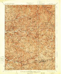
1925 Map of Centerpoint
USGS Topo · Published 1932About this map
McElroy Creek and its many winding tributaries define the deeply dissected landscape of north-central West Virginia, where small settlements grew along the narrow valley floors. By the mid-1920s, the Baltimore and Ohio RR connected towns like Salem and Industrial in the south, while post offices such as Alvy P O and Lima P O served more isolated farming communities. The map reveals an incredible density of local institutions, with dozens of family-named schools like the Jockeycamp Run School and McMillen School appearing every few miles. Rural life centered on these small schoolhouses and remote churches, including Cascara Church and Pisgah Church, which remain key markers for genealogists and local historians. This era shows a settled but decentralized region before the modernization of the road network significantly altered the layout of rural Doddridge County.
Find a feature on this map
141 named features on this map. Tap any name to fly to it.
Don’t see what you’re looking for? This feature index may not catch every label — zoom into the map to look around manually.
Map Details
Editions of this 1925 Centerpoint Map
4 editions found

Other maps of this area

1902 · Clarksburg
USGS Topo · 1:62,500

1903 · Littleton
USGS Topo · 1:62,500

1904 · Weston
USGS Topo · 1:62,500

1904 · Vadis
USGS Topo · 1:62,500

1905 · Mannington
USGS Topo · 1:62,500

1905 · Centerpoint
USGS Topo · 1:62,500

1905 · West Union
USGS Topo · 1:62,500

1905 · Littleton
USGS Topo · 1:62,500

1906 · Holbrook
USGS Topo · 1:62,500

1906 · New Martinsville
USGS Topo · 1:62,500