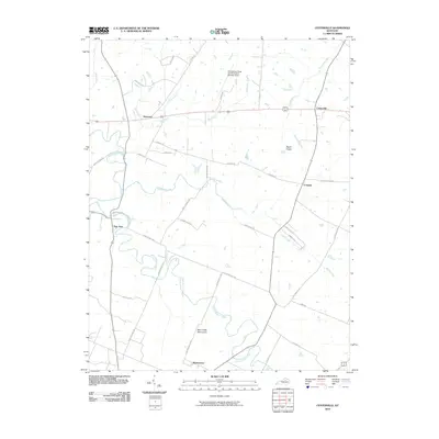
2010 Map of Centerville
USGS Topo · Published 2010About this map
North Elkhorn Creek winds through the heart of this central Kentucky landscape, defining a terrain of rolling drainage basins and long-established thoroughfares. The map highlights a series of historic crossroads and small settlements such as Newtown, Centerville, and New Zion, reflecting the deep-rooted agricultural and equestrian heritage of the Bluegrass region. In the south, the Man-O-War Monument stands as a significant landmark along Huffman Mill Pike, signaling the area's strong association with thoroughbred history.
Find a feature on this map
40 named features on this map. Tap any name to fly to it.
Don’t see what you’re looking for? This feature index may not catch every label — zoom into the map to look around manually.
Map Details
Editions of this 2010 Centerville Map
This is the sole edition of this map. No revisions or reprints were ever made.
Other maps of this area

1906 · Georgetown
USGS Topo · 1:62,500

1908 · Georgetown
USGS Topo · 1:62,500

1927 · Lexington
USGS Topo · 1:48,000

1929 · Cynthiana
USGS Topo · 1:48,000

1929 · Lexington
USGS Topo · 1:62,500

1934 · Cynthiana
USGS Topo · 1:62,500

1939 · Sadieville
USGS Topo · 1:62,500

1950 · Lexington East
USGS Topo · 1:24,000

1950 · Lexington West
USGS Topo · 1:24,000

1952 · Clintonville
USGS Topo · 1:24,000