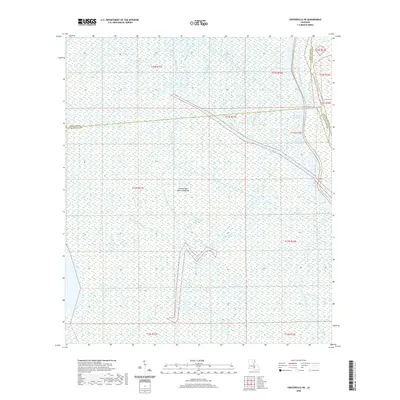
2020 Map of Centerville NE
USGS Topo · Published 2020About this map
The Atchafalaya Basin Floodway dominates this low-lying landscape, where the borders of Iberia, St. Martin, and Assumption Parishes converge. This area is defined by a dense network of slow-moving water bodies, including Old River and the complex channels of Bayou Long, which branches into the West Fork Bayou Long, Middle Fork Bayou Long, and Little Bayou Long.
Find a feature on this map
25 named features on this map. Tap any name to fly to it.
Don’t see what you’re looking for? This feature index may not catch every label — zoom into the map to look around manually.
Map Details
Editions of this 2020 Centerville NE Map
This is the sole edition of this map. No revisions or reprints were ever made.
Other maps of this area

1935 · Chicot Lake
USGS Topo · 1:62,500

1936 · White Castle
USGS Topo · 1:62,500

1945 · New Orleans
USGS Topo · 1:250,000

1948 · Foster
USGS Topo · 1:62,500

1953 · Napoleonville
USGS Topo · 1:62,500

1954 · Chicot Lake
USGS Topo · 1:62,500

1954 · Baton Rouge
USGS Topo · 1:250,000
1955 · Chicot Lake
USGS Topo · 1:62,500

1956 · Baton Rouge
USGS Topo · 1:250,000

1959 · Foster
USGS Topo · 1:62,500