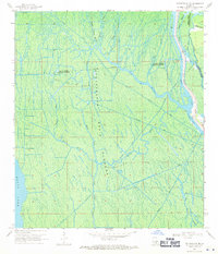
1969 Map of Centerville NE
USGS Topo · Published 1971About this map
The Atchafalaya Basin Floodway dominates this terrain, revealing a landscape defined by an intricate network of drainage and industrial extraction. In the late 1960s, the region was heavily utilized for natural gas production, evidenced by the Gas Field in the northwest and the Mystic Bayou Gas Field further south. These fields are serviced by various canals and pipelines that cut through the dense swamp environment.
Find a feature on this map
26 named features on this map. Tap any name to fly to it.
Don’t see what you’re looking for? This feature index may not catch every label — zoom into the map to look around manually.
Map Details
Editions of this 1969 Centerville NE Map
2 editions found
Other maps of this area

1935 · Chicot Lake
USGS Topo · 1:62,500

1936 · White Castle
USGS Topo · 1:62,500

1945 · New Orleans
USGS Topo · 1:250,000

1948 · Foster
USGS Topo · 1:62,500

1953 · Napoleonville
USGS Topo · 1:62,500

1954 · Chicot Lake
USGS Topo · 1:62,500

1954 · Baton Rouge
USGS Topo · 1:250,000
1955 · Chicot Lake
USGS Topo · 1:62,500

1956 · Baton Rouge
USGS Topo · 1:250,000

1959 · Foster
USGS Topo · 1:62,500