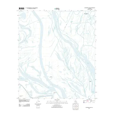
2012 Map of Centerville NW
USGS Topo · Published 2012About this map
The W Atchafalaya Basin Spillway dominates this hydrologically complex landscape in Iberia Parish, where the interplay of natural waterways and industrial modification is clearly visible. This 2012 survey illustrates a region defined by its reliance on water-based transit and energy extraction, featuring the prominent Keelboat Pass and the engineered Mecom Cut. The presence of the Myette Point Oil and Gas Field and the Charenton Oil and Gas Field highlights the region's historical and ongoing role in Louisiana's energy economy.
Find a feature on this map
16 named features on this map. Tap any name to fly to it.
Don’t see what you’re looking for? This feature index may not catch every label — zoom into the map to look around manually.
Map Details
Editions of this 2012 Centerville NW Map
This is the sole edition of this map. No revisions or reprints were ever made.
Other maps of this area

1935 · Chicot Lake
USGS Topo · 1:62,500

1937 · Jeanerette
USGS Topo · 1:62,500

1941 · Loreauville
USGS Topo · 1:62,500

1945 · New Orleans
USGS Topo · 1:250,000

1948 · Foster
USGS Topo · 1:62,500

1954 · Chicot Lake
USGS Topo · 1:62,500

1954 · Loreauville
USGS Topo · 1:62,500

1954 · Jeanerette
USGS Topo · 1:62,500

1954 · Baton Rouge
USGS Topo · 1:250,000
1955 · Chicot Lake
USGS Topo · 1:62,500