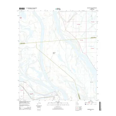
2015 Map of Centerville NW
USGS Topo · Published 2015About this map
The Atchafalaya Basin Floodway dominates this landscape, revealing the intricate water systems where Iberia, St. Mary, and St. Martin Parishes converge. The map documents a complex network of bayous and man-made alterations, including Little Bayou Pigeon, Big Bayou Pigeon, and the Mecom Cut. These waterways define the movement through the basin, shaping landforms such as Shaws Island, Taylor Point, and Miller Point.
Find a feature on this map
19 named features on this map. Tap any name to fly to it.
Don’t see what you’re looking for? This feature index may not catch every label — zoom into the map to look around manually.
Map Details
Editions of this 2015 Centerville NW Map
This is the sole edition of this map. No revisions or reprints were ever made.
Other maps of this area

1935 · Chicot Lake
USGS Topo · 1:62,500

1937 · Jeanerette
USGS Topo · 1:62,500

1941 · Loreauville
USGS Topo · 1:62,500

1945 · New Orleans
USGS Topo · 1:250,000

1948 · Foster
USGS Topo · 1:62,500

1954 · Chicot Lake
USGS Topo · 1:62,500

1954 · Loreauville
USGS Topo · 1:62,500

1954 · Jeanerette
USGS Topo · 1:62,500

1954 · Baton Rouge
USGS Topo · 1:250,000
1955 · Chicot Lake
USGS Topo · 1:62,500