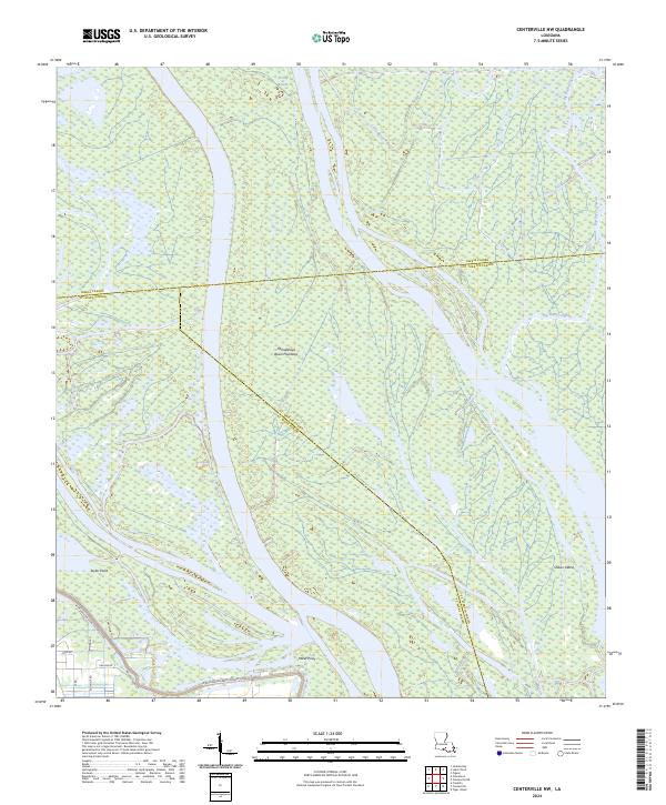
2024 Map of Centerville NW
USGS Topo · Published 2024About this map
The Atchafalaya Basin Floodway dominates this landscape, showing a complex network of wetlands and shifting watercourses in southern Louisiana. The terrain is defined by the W Atchafalaya Basin Spillway Levee, which acts as a massive engineering boundary against the seasonal pulse of the river system. Within the basin, landforms like Turkey Island and Shaws Island emerge from the saturated environment, while the paths of Little Bayou Pigeon and Big Bayou Pigeon trace the natural drainage of the swamp. In the southwestern corner, a modest cluster of roads including Chatsworth St and Bellview Front St marks a rare point of dry-ground development near Taylor Point. This area reflects the constant tension between human settlement and the alluvial forces of the basin, where points of land like Millet Point serve as vital landmarks for navigation and local geography.
Find a feature on this map
25 named features on this map. Tap any name to fly to it.
Don’t see what you’re looking for? This feature index may not catch every label — zoom into the map to look around manually.
Map Details
Editions of this 2024 Centerville NW Map
This is the sole edition of this map. No revisions or reprints were ever made.
Other maps of this area

1935 · Chicot Lake
USGS Topo · 1:62,500

1937 · Jeanerette
USGS Topo · 1:62,500

1941 · Loreauville
USGS Topo · 1:62,500

1945 · New Orleans
USGS Topo · 1:250,000

1948 · Foster
USGS Topo · 1:62,500

1954 · Chicot Lake
USGS Topo · 1:62,500

1954 · Loreauville
USGS Topo · 1:62,500

1954 · Jeanerette
USGS Topo · 1:62,500

1954 · Baton Rouge
USGS Topo · 1:250,000
1955 · Chicot Lake
USGS Topo · 1:62,500