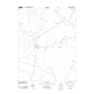
2011 Map of Centerville
USGS Topo · Published 2011About this map
Centerville sits at the confluence of several Ozark waterways, where the West Fork Black River and Middle Fork Black River wind through a landscape defined by deeply etched hollows and ridges. This 2011 survey illustrates the rural character of Reynolds County, documenting numerous family-named landmarks such as Howell Cemetery, Johnson Cemetery, and Rayfield Cemetery. The terrain is particularly complex south of Low Gap Ridge, where dozens of named geographic features like McLean Hollow, Parks Hollow, and Clarady Bluff dictate the winding paths of local routes like Old Hwy 21. To the west, Sinking Creek meanders through the valley, while the presence of the Ray Johnson Airport south of the main settlement indicates the regional infrastructure connecting these hillside communities. Modern recreational access is noted via the Karkaghne Scenic Dr, which follows the high ground above Carty Branch.
Find a feature on this map
46 named features on this map. Tap any name to fly to it.
Don’t see what you’re looking for? This feature index may not catch every label — zoom into the map to look around manually.
Map Details
Editions of this 2011 Centerville Map
This is the sole edition of this map. No revisions or reprints were ever made.
Other maps of this area

1924 · Edgehill
USGS Topo · 1:62,500

1926 · Edgehill
USGS Topo · 1:62,500

1943 · Lesterville
USGS Topo · 1:62,500

1943 · Boss
USGS Topo · 1:62,500

1944 · Corridon
USGS Topo · 1:62,500

1946 · Lesterville
USGS Topo · 1:62,500

1946 · Boss
USGS Topo · 1:62,500

1947 · Corridon
USGS Topo · 1:62,500

1949 · Rolla
USGS Topo · 1:250,000

1953 · Rolla
USGS Topo · 1:250,000