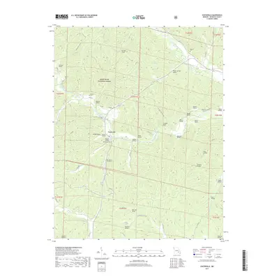
2017 Map of Centerville
USGS Topo · Published 2017About this map
Centerville serves as the focal point of this Reynolds County landscape, situated near the confluence of several significant waterways. The town is flanked by the West Fork Black River to the west and the Middle Fork Black River to the northeast, illustrating a classic Ozark settlement pattern where community life follows the valley floors. High ridges and deep hollows define the surrounding terrain within the Mark Twain National Forest, including notable landmarks like Clarady Bluff and Low Gap Ridge.
Find a feature on this map
67 named features on this map. Tap any name to fly to it.
Don’t see what you’re looking for? This feature index may not catch every label — zoom into the map to look around manually.
Map Details
Editions of this 2017 Centerville Map
This is the sole edition of this map. No revisions or reprints were ever made.
Other maps of this area

1924 · Edgehill
USGS Topo · 1:62,500

1926 · Edgehill
USGS Topo · 1:62,500

1943 · Lesterville
USGS Topo · 1:62,500

1943 · Boss
USGS Topo · 1:62,500

1944 · Corridon
USGS Topo · 1:62,500

1946 · Lesterville
USGS Topo · 1:62,500

1946 · Boss
USGS Topo · 1:62,500

1947 · Corridon
USGS Topo · 1:62,500

1949 · Rolla
USGS Topo · 1:250,000

1953 · Rolla
USGS Topo · 1:250,000