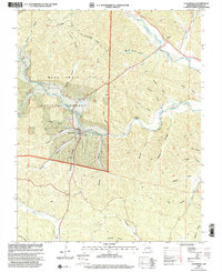
1999 Map of Centerville
USGS Topo · Published 2002About this map
Centerville sits at the confluence of several significant waterways within the Mark Twain National Forest, most notably the West Fork Black River and the Middle Fork Black River. The town serves as a central hub in a landscape defined by deep, naming-rich drainage patterns such as Stillwell Hollow, McLean Hollow, and Hunter Hollow. This 1999 revision, derived from imagery and 1966 topography, reveals a rural infrastructure focused on the river forks, featuring a Landing Strip and Water Tank near the town center. Local history is anchored by several family-named burial grounds, including the Rayfield Cem, Johnson Cem, and Howell Cem. The presence of the Ozark Trail and Scenic Drive suggests the area's transition into a recreational landscape by the late 20th century, even as traditional landmarks like Clarady Bluff and Reeds Spring remain prominent.
Find a feature on this map
45 named features on this map. Tap any name to fly to it.
Don’t see what you’re looking for? This feature index may not catch every label — zoom into the map to look around manually.
Map Details
Editions of this 1999 Centerville Map
This is the sole edition of this map. No revisions or reprints were ever made.
Other maps of this area

1924 · Edgehill
USGS Topo · 1:62,500

1926 · Edgehill
USGS Topo · 1:62,500

1943 · Lesterville
USGS Topo · 1:62,500

1943 · Boss
USGS Topo · 1:62,500

1944 · Corridon
USGS Topo · 1:62,500

1946 · Lesterville
USGS Topo · 1:62,500

1946 · Boss
USGS Topo · 1:62,500

1947 · Corridon
USGS Topo · 1:62,500

1949 · Rolla
USGS Topo · 1:250,000

1953 · Rolla
USGS Topo · 1:250,000