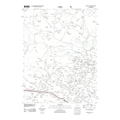
2011 Map of Central City
USGS Topo · Published 2011About this map
Central City remains the focal point of this dense network of mining claims and high-altitude settlements. The landscape is defined by an extraordinary concentration of historical mineral extraction sites, ranging from the Gold Reserve Mine on Montana Mountain to the Seeman Tunnel Mine near Fall River. The transition between the industrial legacy of these mountains and contemporary recreation is evident in the proximity of sites like Pickle Gulch Campground to the honeycomb of shafts and tunnels that shaped the region's economy. High above the valley floors, the mountain peaks—including Colorado Mountain, Dakota Hill, and Maryland Mountain—overlook a complex grid of roads like Apex Valley RD and Virginia Canyon RD. The map reveals the intricate social fabric of the mining era through its numerous fraternal burial grounds, such as the Knights of Pythias Cemetery and the Independent Order of Oddfellows Cemetery, which sit alongside established towns like Nevadaville and Dumont.
Find a feature on this map
388 named features on this map. Tap any name to fly to it.
Don’t see what you’re looking for? This feature index may not catch every label — zoom into the map to look around manually.
Map Details
Editions of this 2011 Central City Map
This is the sole edition of this map. No revisions or reprints were ever made.
Other maps of this area

1899 · West Denver
USGS Topo · 1:125,000

1903 · Georgetown
USGS Topo · 1:62,500

1905 · Central City
USGS Topo · 1:62,500

1905 · Georgetown
USGS Topo · 1:62,500

1906 · Blackhawk
USGS Topo · 1:62,500

1910 · Central City
USGS Topo · 1:62,500

1912 · Central City
USGS Topo · 1:62,500

1942 · Nederland
USGS Topo · 1:24,000

1942 · Central City
USGS Topo · 1:24,000

1942 · Tungsten
USGS Topo · 1:24,000
Featured Places
- Idaho Springs, CO
- Black Hawk, CO
- Gilson Gulch, CO
- Pickle Gulch Group Campground, CO
- Columbine Campground, CO