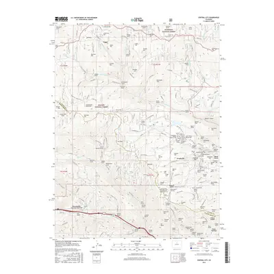
2016 Map of Central City
USGS Topo · Published 2016About this map
Central City and Black Hawk serve as the focal points of this Colorado high-country survey, illustrating the dense concentration of historical mining infrastructure and memorial sites. The terrain is marked by a complex network of gulches and peaks, including Mt Pisgah and Seaton Mtn, which historically dictated the movement of goods and people. A striking cluster of fraternal and community burial grounds, such as the Knights of Pythias Cem, Independent Order of Oddfellows Cem, and Masonic Cem, reveals the deeply rooted social fabric of these mountain settlements.
Find a feature on this map
166 named features on this map. Tap any name to fly to it.
Don’t see what you’re looking for? This feature index may not catch every label — zoom into the map to look around manually.
Map Details
Editions of this 2016 Central City Map
This is the sole edition of this map. No revisions or reprints were ever made.
Other maps of this area

1899 · West Denver
USGS Topo · 1:125,000

1903 · Georgetown
USGS Topo · 1:62,500

1905 · Central City
USGS Topo · 1:62,500

1905 · Georgetown
USGS Topo · 1:62,500

1906 · Blackhawk
USGS Topo · 1:62,500

1910 · Central City
USGS Topo · 1:62,500

1912 · Central City
USGS Topo · 1:62,500

1942 · Nederland
USGS Topo · 1:24,000

1942 · Central City
USGS Topo · 1:24,000

1942 · Tungsten
USGS Topo · 1:24,000
Featured Places
- Idaho Springs, CO
- Black Hawk, CO
- Gilson Gulch, CO
- Pickle Gulch Group Campground, CO
- Columbine Campground, CO