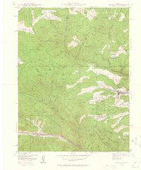
1942 Map of Central City
USGS Topo · Published 1960About this map
Central City and the surrounding mining districts are captured here at a critical moment in 1942, reflecting decades of hard-rock extraction and the early twentieth-century shift toward large-scale industrial works. The landscape is heavily marked by the legacy of the Gold Rush, with dozens of named gulches and hills like Winnebago Hill, Bates Hill, and Mammoth Hill clustered near the town sites. Further into the mountains, infrastructure like the Fall River Power Plant and an Abandoned Flume near Mt Pisgah illustrate the immense engineering required to move water and power through this high-altitude terrain.
Find a feature on this map
85 named features on this map. Tap any name to fly to it.
Don’t see what you’re looking for? This feature index may not catch every label — zoom into the map to look around manually.
Map Details
Editions of this 1942 Central City Map
5 editions found
Other maps of this area

1899 · West Denver
USGS Topo · 1:125,000

1903 · Georgetown
USGS Topo · 1:62,500

1905 · Central City
USGS Topo · 1:62,500

1905 · Georgetown
USGS Topo · 1:62,500

1906 · Blackhawk
USGS Topo · 1:62,500

1910 · Central City
USGS Topo · 1:62,500

1912 · Central City
USGS Topo · 1:62,500

1942 · Nederland
USGS Topo · 1:24,000

1942 · Central City
USGS Topo · 1:24,000

1942 · Tungsten
USGS Topo · 1:24,000