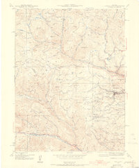
1942 Map of Central City
USGS Topo · Published 1955About this map
Central City and its neighboring gold-mining districts are documented here just before the mid-century, following a 1942 survey. The landscape is defined by the intense industrial footprint of the Colorado Gold Rush, featuring an intricate network of gulches and mines that transformed the terrain of the Gilpin Co and Clear Creek Co border. Steep slopes are marked by specific mining landmarks like Chain O' Mine and the Pittsburg Mine, alongside the massive excavation of The Glory Hole. Evidence of early utility infrastructure appears with the Fall River Power Plant and various flume lines, some already marked as abandoned. Settlements such as Nevadaville and Apex are shown alongside smaller locales like Nugget and American City, while the Bald Mtn Cem stands as a permanent record of the era's population. This survey captures the transition from active extraction to the preservation of these mountain camps within the Roosevelt National Forest.
Find a feature on this map
80 named features on this map. Tap any name to fly to it.
Don’t see what you’re looking for? This feature index may not catch every label — zoom into the map to look around manually.
Map Details
Editions of this 1942 Central City Map
5 editions found
Other maps of this area

1899 · West Denver
USGS Topo · 1:125,000

1903 · Georgetown
USGS Topo · 1:62,500

1905 · Central City
USGS Topo · 1:62,500

1905 · Georgetown
USGS Topo · 1:62,500

1906 · Blackhawk
USGS Topo · 1:62,500

1910 · Central City
USGS Topo · 1:62,500

1912 · Central City
USGS Topo · 1:62,500

1942 · Nederland
USGS Topo · 1:24,000

1942 · Central City
USGS Topo · 1:24,000

1942 · Tungsten
USGS Topo · 1:24,000