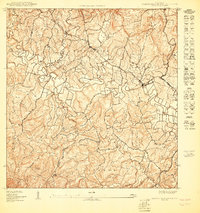
1950 Map of Central La Plata NE
USGS Topo · Published 1950About this map
Central La Plata stands as a focal point in this 1950 topographical study, situated within a complex network of waterways that define the municipal border between Municipio de Moca and Municipio de San Sebastián. The landscape is dominated by the confluence of major river systems, including the Rio Culebrinas, Rio Sonador, and Rio Guatemala. These rivers and their numerous tributaries, such as Quebrada de las Damas and Quebrada del Salto, carve through prominent terrain features like Hato Arriba and Voladoras.
Find a feature on this map
35 named features on this map. Tap any name to fly to it.
Don’t see what you’re looking for? This feature index may not catch every label — zoom into the map to look around manually.
Map Details
Editions of this 1950 Central La Plata NE Map
This is the sole edition of this map. No revisions or reprints were ever made.
Other maps of this area

1937 · Moca
USGS Topo · 1:20,000

1938 · Alto Sano
USGS Topo · 1:20,000

1938 · San Sebastian
USGS Topo · 1:20,000

1938 · Quebradillas
USGS Topo · 1:20,000

1941 · Moca
USGS Topo · 1:30,000

1941 · San Sebastian
USGS Topo · 1:30,000

1942 · Moca
USGS Topo · 1:30,000

1942 · Central La Plata
USGS Topo · 1:30,000
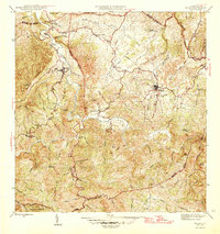
1946 · Ciales
USGS Topo · 1:30,000
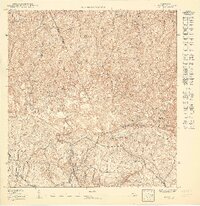
1950 · Moca SE
USGS Topo · 1:10,000
Featured Places
- Sector Serrano, San Sebastián
- Sector Los Crespos, San Sebastián
- Sector Ramos, San Sebastián
- Sector Bosque, Moca
- Reparto Feliciano, San Sebastián